
Tike, the Information Centre of the Ministry of Agriculture and Forestry in Finland, is an expert organization providing services to other government organizations, including the Finnish Agency of Rural Affairs (FARA) and Finnish Food Safety Authority (FFSA). In addition to statistical and research services, Tike provides information technology services and builds web mapping applications to support their customers.
FARA has the responsibility in Finland for managing the agricultural subsidies transferred by the European Union. The amounts of money transferred on the basis of the data is quite high, and impacts large numbers of farmers, so the systems supporting FARA are very sensitive — they must be reliable and accurate, or there will be political consequences.
When the subsidy control system was changed to use WFS-T instead of a tailored proprietary transfer protocol, Tike selected OpenGeo's GeoServer, as the application with the best combination of full standards support and ease of deployment. Jukka Rahkonen is a GIS specialist with Tike, “I took my first lessons about WFS with MapServer, but soon I discovered that we would need WFS-T. Next I tried deegree but I am not an IT person, I am an agronomist, and configuring deegree was too hard for me. GeoServer started to work for me out of the box, and some WFS clients could even show the map from GeoServer WFS.”
As Tike moved the new WFS service into production, they researched options for support. “Even after two years experience on using basic WFS, starting to use WFS-T was a big step, and the EU subsidy application is very critical”, said Rahkonen, “The system just must work, and we wanted some extra security. OpenGeo was a natural choice because of their professional touch and best possible connection with Geoserver codebase. We did not want to make temporary fixes and be forced to maintain our own fork thereafter.”
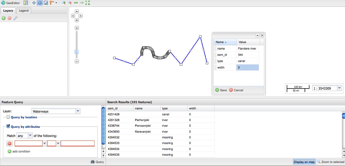
GeoEditor Application
The Enterprise support agreement Tike selected included priority bug-fixes and bundled hours of custom development. Deploying on their Oracle database, Tike found some issues in GeoServer's Oracle support, which OpenGeo addressed immediately. “[With OpenGeo, we got] better service, less expensive, faster response, no need to fight if a bug is a bug or something else”, says Rahkonen.
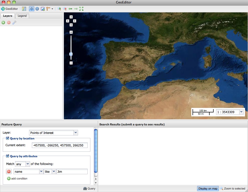
GeoEditor Application
Tike also used their custom development hours, to prepare technology for their future applications, building a GeoExt application called "GeoEditor". The GeoEditor is a 100% web based application for managing data entry and manipulation. It uses the WMS and WFS services already published by Tike, and provides the user interface for interacting with the services. The future for GeoEditor is expected to be in applications with potentially very large user bases, where deploying custom desktop software is simply not an options.
The GeoEditor development and ongoing GeoServer support have been a successful relationship between Tike and OpenGeo. Asked how he felt about working with OpenGeo, Rahkonen said, “I can't say how it could be any better.”
Other Case Studies
Greek Regulatory Authority for Energy
The Greek Regulatory Authority for Energy (RAE) Geospatial Map is a web application developed by GET, created during RAE’s Spatial Data Infrastructure implementation. Development was based on: GED SDI Portal®, created and distributed by GET Ltd., under GPL V3, OpenGeo Suite, and Geonetwork OpenSource.
City of New York: A Hybrid Architecture
The City of New York Department of IT built a mapping architecture mixing proprietary and open source components to serve maps for multiple agencies and applications.
MassGIS: A GeoServer Enterprise Story

OpenGeo provides enterprise GeoServer support for Massachussetts' GIS agency.
Rijkswaterstaat: Connected to Open Source
Rijkswaterstaat calls on OpenGeo to build new open source features and add them back into the core project.
FCC Uses Open Source Tools for National Broadband Map
The Federal Communication Commission's National Broadband Map enables the public to see where broadband coverage is available in the United States. The site is completely powered by open source software including PostGIS, GeoServer, OpenLayers, Wordpress, Linux and Apache.
EBServices uses the OpenGeo Suite to deliver a spatial data extra service to SP-Ausnet a power company in the state of Victoria, Australia.

The City of Asheville’s two highly popular GIS applications, Steep Slope and Priority Places, were improved by implementing a hybrid architecture to include both ESRI and open source components.

OpenGeo provides enterprise support to Portland's regional transit authority, who have built a trip planner using the OpenGeo suite of products.
TsuDat: GeoNode and Disaster Modelling

GeoScience Australia and AIFDR have used web delivery to make tsunami modelling available to emergency managers across Australia in a way that was never possible before.

OpenGeo provides a collaborative map for Landgate, Western Australia's land data authority, using OpenLayers and a Versioning extension to the Web Feature Service Standard.
Tike : GeoServer Enterprise Support

Finnish IT agency Tike brings in OpenGeo to provide production support for GeoServer and custom development of web front-end tools.

International technical consulting firm Sweco hires OpenGeo to build cutting edge feature editing capabilities to the OpenLayers core.
Farallon: San Francisco Enterprise Addressing System

Farallon, an OpenGeo partner, develops a secure, web-based solution for the San Francisco Enterprise Addressing System using open source geospatial technology.