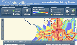
OpenGeo provides government agencies with a standards-compliant way to cost-effectively publish data to the web. The OpenGeo Suite is the perfect solution for architecting systems where citizens can build their own applications around agency data or crowd-source additional information to help governments make more informed policy decisions.
Learn more about how OpenGeo software helps agencies:
OpenGeo's GSA Schedule
OpenGeo is proud to offer the federal government scalable, certified, and supported software and services through our GSA schedule.
Learn more…
Case Studies
City of New York: A Hybrid Architecture
The City of New York Department of IT built a mapping architecture mixing proprietary and open source components to serve maps for multiple agencies and applications.