
Through its use of GeoServer, MassGIS has been able to effectively provide much of its geospatial data via OGC standards to end users.
after a competitive procurement, the agency contracted with OpenGeo for Enterprise Support of its GeoServer deployment to extend GeoServer's functionality and deepen its support resources. Via its partnership with OpenGeo, MassGIS has reaped the unique functionality and cost benefits that supported enterprise open source software has to offer.
Background
MassGIS is the Commonwealth of Massachusetts' Office of Geographic and Environmental Information, established by the state legislature as the official state agency assigned to the collection, storage and dissemination of geographic data. Many people and agencies depend on MassGIS and its comprehensive statewide database of spatial information.
Over the past decade MassGIS has deployed a suite of applications to support various types of online mapping initiatives, including ESRI's ArcIMS, ESRI's ArcGIS Server and GeoServer. Currently eleven state agencies, several local governments, and one federal agency have applications currently using MassGIS' various web map services (see sidebar).
The MassGIS GeoServer is currently serving 851 data layers - including almost all the layers in its standard library - whose volume is close to a terabyte. The data layers represent many types of information, including roads, parcels, schools, aerial photos, and elevation. The MassGIS GeoServer serves these layers in many projections and output formats, and responds to more than 23,000 requests a day.
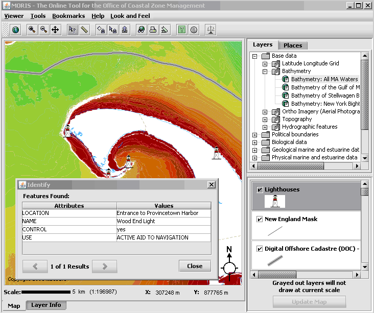 Screenshot of MORIS, the Massachusetts Ocean Resource Information
System, an online mapping tool created by Massachusetts Office of
Coastal Zone Management (CZM) and
MassGIS. MORIS is used to navigate and browse data served by
GeoServer.
Screenshot of MORIS, the Massachusetts Ocean Resource Information
System, an online mapping tool created by Massachusetts Office of
Coastal Zone Management (CZM) and
MassGIS. MORIS is used to navigate and browse data served by
GeoServer.
MassGIS began using WMS software as a data server for the Open Geospatial Consortium's (OGC) Web Map Service (WMS) to support mapping applications such as OLIVER,, a general purpose viewing and download tool for geographic data. When the solution it had been using previously stopped being developed by its vendor, MassGIS looked for a WMS that was actively enhanced and supported by a community of developers. After investigating their options, they chose GeoServer.
Open Source, Supported
MassGIS quickly benefited from working with a mature open source project. Aleda Freeman, GIS Programmer at MassGIS reports,
"One nice aspect [of our GeoServer experience] is the open bug/improvement database JIRA. Another is that the users' and developers' email groups are very active and responses to questions come very quickly. In addition, bug fixes can be tested with the nightly builds so we don't have to wait for a release to know that a bug has been correctly fixed."
While working with GeoServer, Saul Farber (now with PeopleGIS, at that time a software developer for MassGIS) became involved in the GeoServer community and made several key code contributions.
Later, MassGIS determined that it needed GeoServer to read more types of ESRI SDE raster data layers than it was able to at the time. In the summer, MassGIS issued a request for responses from organizations interested in doing the programming work. OpenGeo was selected for its knowledgeable response and experienced staff.
MassGIS purchased an Enterprise contract from OpenGeo. In addition to giving them the implementation hours needed to improve GeoServer's SDE integration, this also gave MassGIS enterprise-level support from top GeoServer developers. Freeman explains:
"MassGIS has a test suite of about 85 requests that need to remain working to support existing applications. During the transition from GeoServer 1.6.5 to 1.7.6 any issues with the requests not running properly were investigated and dealt with promptly."
"Working closely with the developers has also given me a better understanding of how GeoServer works and how it's evolving. I can think about how we might take advantage of new functionality currently in development."
Working with OpenGeo
MassGIS stores its data in Oracle and the ESRI Spatial Database Engine (SDE). In particular, all of its imagery is stored in SDE, and MassGIS had several different types of raster layers. GeoServer (v1.6.5) only supported a few of those kinds of layers, so MassGIS issued a request for responses to extend GeoServer with the new capabilities. Later, the Massachusetts Ocean Partnership contributed additional funding to the project. By August, GeoServer supported all of SDE's raster layers and MassGIS upgraded their GeoServer to version 1.7.6.
Freeman recalls:
"The work to support all the MassGIS SDE raster types is a success - all the types now display properly. OpenGeo completed the work quickly and any issues that cropped up were dealt with promptly. ... Everyone has been very responsive and enthusiastic. I have been working mostly with Justin Deoliveira, Gabriel Roldan and a little with Andrea Aime. I feel that OpenGeo wants to make sure MassGIS' GeoServer implementation continues to work well."
"I think things have worked very smoothly, considering that I'm in Boston, Justin is in New York, Gabriel is in Argentina and Andrea is in Italy. Tools to manage communication have been very helpful, including the [dedicated email list], the Trac database for tasks and hours, and of course JIRA, the overall bug/enhancement database where I can vote and/or watch issues and be informed of changes."
MassGIS has extended its support contract with OpenGeo for another year. MassGIS plans to continue working with OpenGeo to make GeoServer performance improvements and possible further improve GeoServer's SDE integration.
Open Data
Many Massachusetts agencies, either in collaboration with MassGIS or on their own, have built applications--using OpenLayers, MapBuilder, .NET, Flash, and other technologies--that use data provided by GeoServer in OGC standards.
MassGIS' data site is an open site. Instead of running a protected GeoServer for their own applications, they let anyone have access to the datalayers and maintain a documentation wiki with working examples of WMS and WFS requests using MassGIS datalayers. This means that not only state agencies but also citizens can build applications around their data.
Applications that use MassGIS GeoServer WMS or WFS:
- Massachusetts Broadband Institute -- Broadband Survey Map
- Survey Map and Results
- DCR Forestry:
- Massachusetts Urban & Community Forestry Information
- DOE "Schools Near Me":
- School District Profiles
Other Case Studies
Greek Regulatory Authority for Energy
The Greek Regulatory Authority for Energy (RAE) Geospatial Map is a web application developed by GET, created during RAE’s Spatial Data Infrastructure implementation. Development was based on: GED SDI Portal®, created and distributed by GET Ltd., under GPL V3, OpenGeo Suite, and Geonetwork OpenSource.
City of New York: A Hybrid Architecture
The City of New York Department of IT built a mapping architecture mixing proprietary and open source components to serve maps for multiple agencies and applications.
MassGIS: A GeoServer Enterprise Story
OpenGeo provides enterprise GeoServer support for Massachussetts' GIS agency.
Rijkswaterstaat: Connected to Open Source
Rijkswaterstaat calls on OpenGeo to build new open source features and add them back into the core project.
FCC Uses Open Source Tools for National Broadband Map
The Federal Communication Commission's National Broadband Map enables the public to see where broadband coverage is available in the United States. The site is completely powered by open source software including PostGIS, GeoServer, OpenLayers, Wordpress, Linux and Apache.
EBServices uses the OpenGeo Suite to deliver a spatial data extra service to SP-Ausnet a power company in the state of Victoria, Australia.

The City of Asheville’s two highly popular GIS applications, Steep Slope and Priority Places, were improved by implementing a hybrid architecture to include both ESRI and open source components.

OpenGeo provides enterprise support to Portland's regional transit authority, who have built a trip planner using the OpenGeo suite of products.
TsuDat: GeoNode and Disaster Modelling

GeoScience Australia and AIFDR have used web delivery to make tsunami modelling available to emergency managers across Australia in a way that was never possible before.

OpenGeo provides a collaborative map for Landgate, Western Australia's land data authority, using OpenLayers and a Versioning extension to the Web Feature Service Standard.
Tike : GeoServer Enterprise Support

Finnish IT agency Tike brings in OpenGeo to provide production support for GeoServer and custom development of web front-end tools.

International technical consulting firm Sweco hires OpenGeo to build cutting edge feature editing capabilities to the OpenLayers core.
Farallon: San Francisco Enterprise Addressing System

Farallon, an OpenGeo partner, develops a secure, web-based solution for the San Francisco Enterprise Addressing System using open source geospatial technology.