GeoExplorer, and Styler
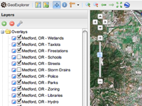
Construct, edit, and style your maps in a web browser. Using GeoExt—a JavaScript user interface framework for building browser-based geospatial applications—our tools bring the look, feel, and functionality of desktop GIS clients to the browser.
- GeoExplorer, to explore data or compose maps.
- GeoEditor, to create or edit data.
- Styler, to style your data.
- Learn more about GeoExt
GeoNode
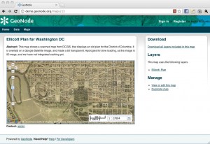
GeoNode facilitates the creation, sharing, and collaborative use of geospatial data. Anyone may sign up for a user account on our live demo, upload and style data, create and share maps, and change permissions. Since it is a demo site, we don’t make any guarantee that your data and maps will always be there but it should hopefully allow you to easily preview the capabilities of GeoNode.
- Check out the live demo
- Learn more about GeoNode
OpenGeo Suite Dashboard
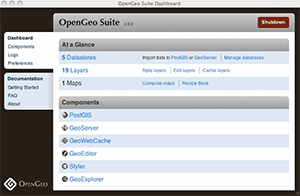
Manage the components of the OpenGeo Suite with the Dashboard. Everything from PostGIS to GeoServer to GeoExplorer—all from one convenient interface.
GeoServer and OpenStreetMap
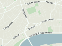
Render OpenStreetMap data with GeoServer. OpenStreetMap is a freely-editable map of the world. But there are two components to the OpenStreetMap project: the data and the rendered map. In this demo, you can see the OpenStreetMap data as styled and rendered using GeoServer, with tiles cached using GeoWebCache. This map can be used as a base layer for any project, and therefore take the place of commercial layers.
- See an OpenStreetMap demo powered by GeoServer
- Learn more about OpenStreetMap
Animated Hurricane Map
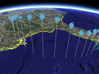
Animate your maps using Google Earth. GeoServer can export data in KML format, the markup language used by Google Maps and Google Earth. GeoServer can also link attributes in your data to Google Earth's time and height parameters. In this demo, the Atlantic hurricane season is displayed. The wind speed for each hurricane is rendered as height (using KML extrudes). Press play in Google Earth's time slider to see the hurricanes in motion.
See more on our gallery…
Our gallery features links to real-world applications using the OpenGeo Suite or underlying technology, including PostGIS, GeoServer, and GeoExt. There are links to real applications, some of which are in production right now serving thousands of users.