GeoExt Resources
- GeoExt Community Site
- GeoExt Issue Tracker
- GeoExt Repository
- GeoExt Chat Room
OpenGeo Services
OpenGeo offers GeoExt core development to add new features to the project.
Our GeoExt Team
Bart van den Eijnden
Bart helps to develop OpenLayers and GeoExt, and has a strong interest in open standards.
Rolando Peñate
Tim Schaub
Tim serves as CTO of OpenGeo, and is an active developer and steering committee member for OpenLayers. Before joining OpenGeo, Tim worked on numerous GIS development projects as a consultant and researcher.
About GeoExt

GeoExt is a JavaScript library that provides a groundwork for creating rich web mapping applications. It combines the web mapping library OpenLayers with Extjs, "a cross-browser JavaScript library for building rich internet applications." GeoExt provides a suite of customizable widgets and data handling support that makes it easy to build applications for viewing, editing, and styling geospatial data.
- Built with Ext JS, cross-browser rich Internet application framework
- Integrated OpenLayers mapping client
- Full dynamic user interactivity and animation without the need for Flash or Silverlight
- Well designed and extensible component model
- Wide variety of generic widgets (grids, charts, trees, layouts, combo boxes, toolbars)
- Flexible, standards-based mapping widgets like legends, pop-ups, and scale choosers
- Printing controls from PDF serving platform, such as page layouts, resolution, and legends
- Customizable layer selection
GeoExt Applications
GeoExt makes it easy to build web mapping applications like the ones below:
- Styler: An interactive styling application for geospatial data.
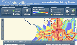
- GeoExplorer: A tool for browsing geospatial data on the web
GeoExt @ OpenGeo
Recent Contributions
OpenGeo is one of the founding partners in the development of GeoExt. We have many committers on staff and fund GeoExt core and application development.
Working closely with other members of the community, our developers have had a hand in every component of GeoExt, including:
- The map panel, layer tree, legend and Popup widgets.
- The store classes that facilitate easy handling of data within GeoExt applications.
Core Development Roadmap
GeoExt should provide components that make it easy to export the current map to a variety of formats. Foremost among these is embedding the current view to a webpage or blog. Past that it would be great to export in a variety of formats, like Google Earth, PDF, or as another GeoExt application with alternate controls.
Creating new geometry from COGO directions is a common use case for web editing tools in county and municipal jurisdictions. This work item will create a GUI for users to enter COGO directions and return traverse data model suitable for converting to a feature or serializing to a database.
Unique Values and Thematic Maps
Styling interfaces for thematic mapping require the classification of data, and the assignment of styles to each classification. This item would create a user interface for managing the style groups in a thematic map, and displaying the unique values in categorical data layers.