Network Capacity Mapping Tool
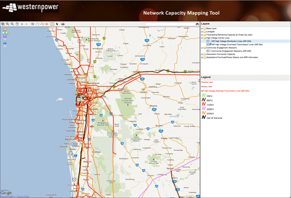
The Network Capacity Mapping Tool was developed for Western Power by Landgate. It is designed to assist Western Power in its efforts to make planning and forecasts of remaining capacity information readily available to organizations involved in land and property development. The primary aim is to provide the land and property planning and development sector with a self service online map-viewer application which enables them to visualize Western Power’s forecast of remaining capacity, by substation supply catchment area, for the next 20 years. The Network Capacity Mapping Tool was built using OpenLayers, GeoServer, GeoWebCache, GeoExt, PostGIS along with Mapserver and Mapfish.