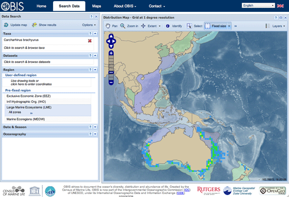
OBIS Sea Map
The Ocean Biogeographic Information System (OBIS) created this Sea Map as its primary mapping portal, built by researchers at Rutgers University and Duke University. As an OpenGeo Suite Enterprise Edition client, they funded the development of GeoServer SQL Views to be able to make maps of diverse species via data stored as one database with 27 million rows.
See the press release about this application.