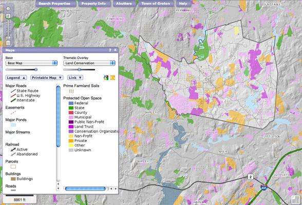
MapGeo Parcel Viewer
MapGeo is a hosted web mapping solution designed to provide local governments, businesses and the public easy access to local maps and detailed property information. The application is configured quickly and cost effectively for local governments thus responding to increasing demand for high performance, yet affordable web mapping solutions. Developed by Applied Geographics, Inc., MapGeo was built using PostGIS, GeoServer, and GeoWebCache. It also takes advantage of HTML5 features and is hosted via Amazon EC2 and S3.
This particular application shows the town of Groton, Massachusetts.